Project Description
This capstone developed a methodology to estimate subsurface utility infrastructure density (3D volumetric approach) within NYC from NYC geometry data for public right of way area calculations, to permit a subsequent estimation of a utility pricing gap within NYC to support development of revenue sources to finance utilidors.
Methodology: Transformation method by Alain Bertaud
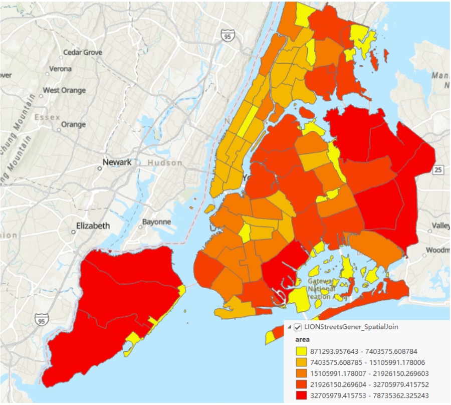
Create surface density metrics and match them with road surface area from LION to show how to convert surface density to subsurface density.
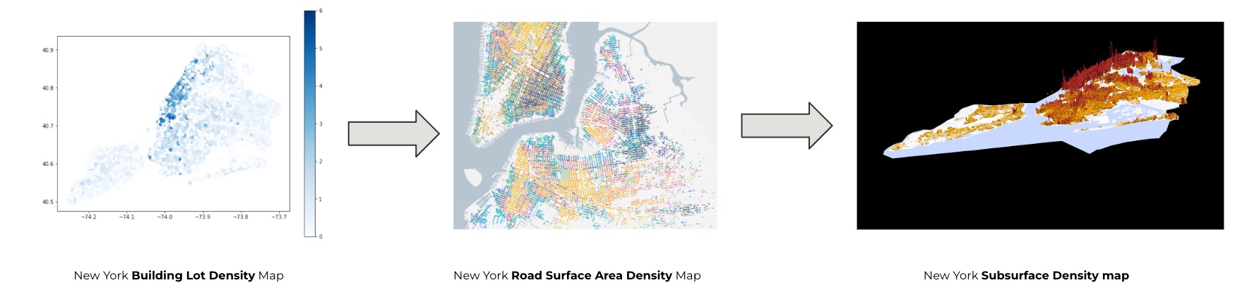
Density Maps
Surface Density Map
Road Area Map
Subsurface Density Map
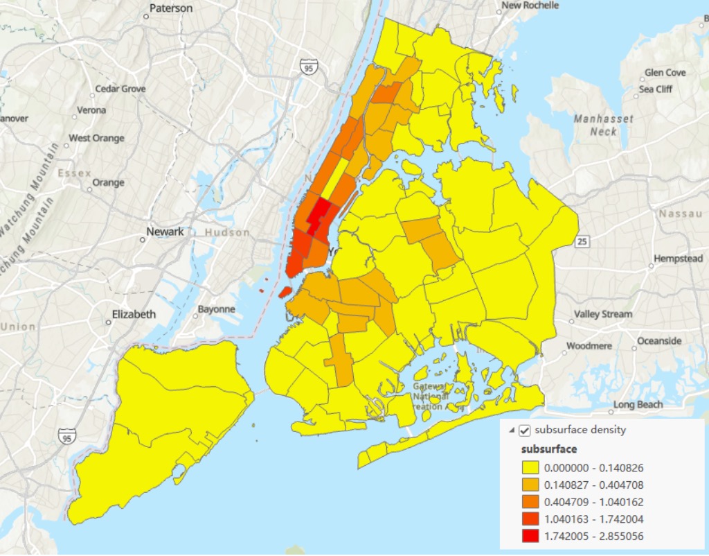
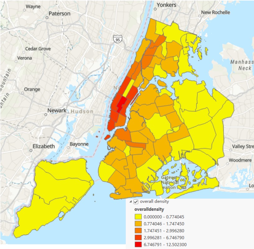
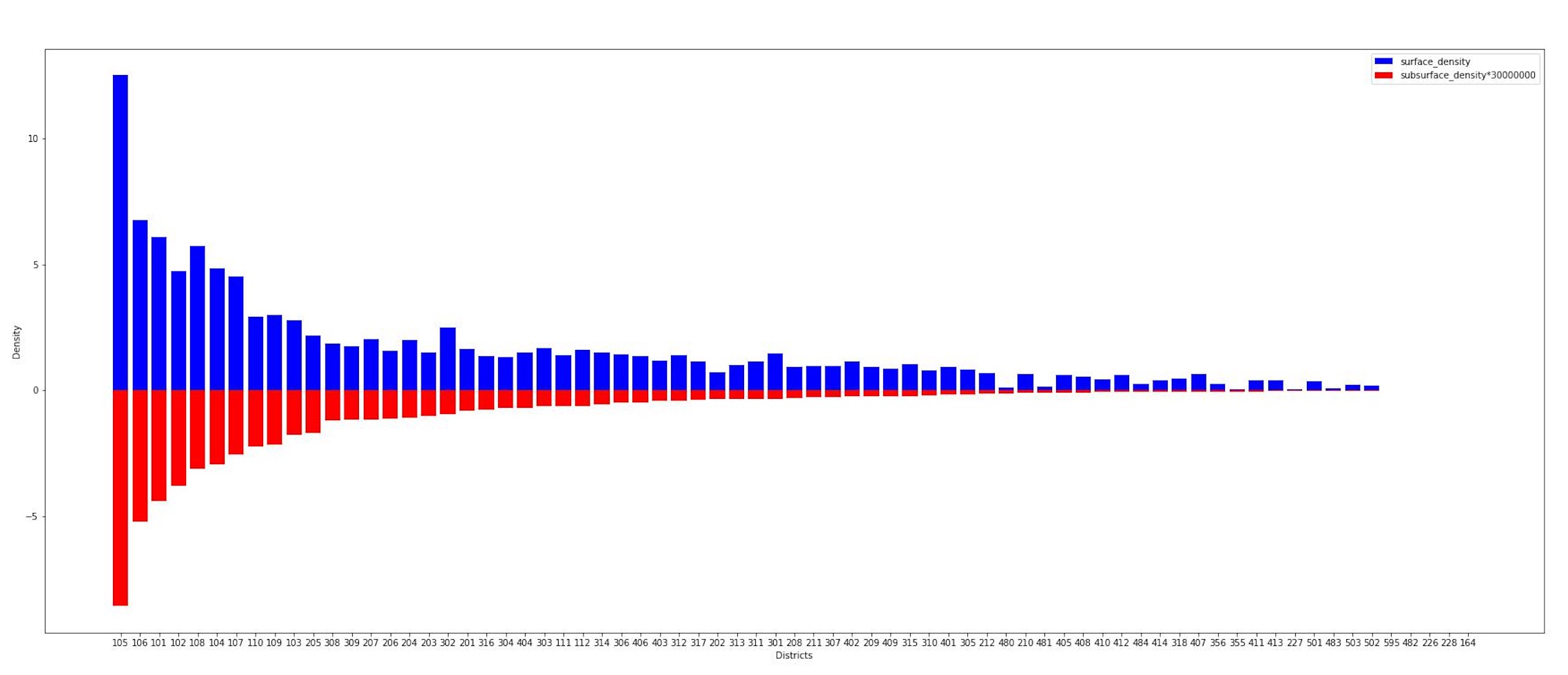
Density Distribution by Districts
The results shown in Figure indicate that the districts with the highest surface densities had the highest subsurface densities which means subsurface density reflects surface density , which confirms the hypothesis that subsurface infrastructure density should mirror surface density.
Project GitHub
The source code for this project can be found on GitHub. Please visit the project's GitHub page.